Eleven Trailheads, Two Bark Parks, and the Largest Earthen Fort of the Civil War
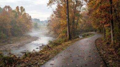
Murfreesboro is a driving town. It grew that way, along wide roads built for the volume of traffic a fast-growing county produces, and most people experience it at thirty-five miles an hour with the windows up. Which is why the greenway is such a strange and welcome thing: a long ribbon of pavement that runs behind all of it, along the water, where the city sounds like a river instead of a road.
It is the single best free thing Murfreesboro owns. Here is how to actually use it.
Start with the trailheads, not the trail
The mistake newcomers make is trying to find “the greenway,” as though it were one place with one entrance. It is a system, and the way in is whichever trailhead is closest to you. The Stones River Trail alone has eleven of them.
Every trailhead has parking. That sounds mundane and it is the most useful fact in this article — it means you never have to plan a greenway walk more than about four minutes in advance. Many of the trailheads also have restrooms, picnic shelters and water fountains, which is what separates a trail you use once from a trail you use on a Tuesday.
Two of them have bark parks, and several have launch points for kayaks and canoes, so the river is not just scenery you walk past. You can put a boat on it.
The short one is the one to walk first
If you only have an hour, take the Lytle Creek Trail. It runs about 1.1 miles from Cannonsburgh Village to Old Fort Park, where it ties into the Stones River Trail — which means it is both a pleasant short walk and the on-ramp to everything else.
It is also the most narratively dense mile in town. Cannonsburgh Village at one end is a recreated pioneer village that operates as a free outdoor museum in the warm months, a reminder that Murfreesboro was a settlement with a name before it was a suburb with an exit number.
You are walking through the largest earthen fort of the Civil War
The greenway's real trick is that it doubles as a history trail, and most people on it have no idea how much is underfoot.
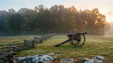
The paved sections connect to McFadden Farm, General Bragg's headquarters, Redoubt Brannan and Fortress Rosecrans — all part of Stones River National Battlefield. Fortress Rosecrans is the one worth stopping for. Union troops built it between January and June of 1863, immediately after the battle fought here at the turn of that year, and it was the largest enclosed earthen fortification constructed during the Civil War. Nearly three miles of earthworks, thrown up by soldiers with shovels, to turn Murfreesboro into the supply depot that fed the Union advance toward Chattanooga.
Most of it is gone. Enough remains that you can stand on a walking path in the middle of a growing Southern city and put your hand on a wall that men built in eight-hour shifts, forty thousand of them camped in the fields around here, in the winter after the worst two days this county ever had.
Practical notes
The greenway is paved, which means strollers, road bikes, wheelchairs and inline skates all work on it. It is open year round, dawn to dusk. It follows the Stones River and Lytle Creek, so it stays shaded and it stays cooler than the parking lots above it — which matters enormously in July.
Go early. Middle Tennessee mornings in the fall are the argument for living here.
Afterward, the Square is a short hop from the Cannonsburgh end — our guide to the best restaurants on the Murfreesboro Square covers where to land when you are done walking. And for everything else worth doing in town, start with our local's guide to Murfreesboro.