City Council advances Stonesbattle Parkway Corridor Plan to manage growth and enhance mobility
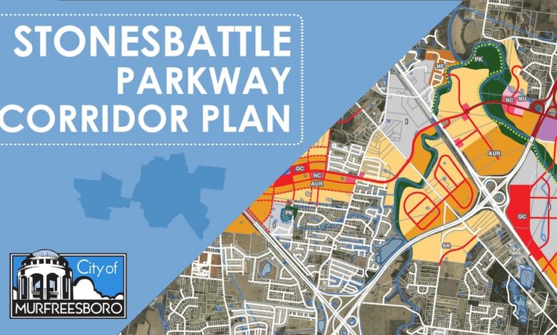
The City of Murfreesboro is moving forward with the Stonesbattle Parkway Corridor Plan, a strategic economic development and transportation initiative designed to accommodate the City’s rapid population growth and provide a critical east-west connection across the community. The City developed the detailed small-area land-use and transportation plan in anticipation of the future Cherry Lane/Stonesbattle Parkway roadway.
The Murfreesboro City Council on Thursday, May 21, 2026, approved a Resolution of Support and Acknowledgement for the Plan. Pape Dawson, formerly Ragan Smith, drafted the Plan, which provides a comprehensive framework for how land use, zoning, and development should evolve along the new east-west corridor. The Planning Commission adopted the Plan, May 6, 2026, following a public hearing. It was also presented to a Joint Conceptual Workshop of the Planning Commission and City Council on January 7.
“This plan is about being proactive rather than reactive,” said Mayor Shane McFarland, noting that the initiative aims to balance economic development with the preservation of community character.
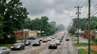
The proposed parkway aims to alleviate traffic pressure on existing major arteries such as Memorial Boulevard, Old Fort Parkway, and Medical Center Parkway. By creating a continuous route from Lebanon Pike near Walter Hill through to Veterans Parkway in the Blackman area, City officials intend to offer motorists an alternative path across the City that bypasses central congestion.
The corridor, which incorporates the existing Cherry Lane, is planned as a major arterial roadway. Depending on the segment, the design features four-lane divided sections with medians, and five-lane sections with center turn lanes to support projected daily traffic volume.
The comprehensive Plan includes four key phases:
- Phase 1: Evaluation of existing conditions along the Cherry Lane corridor
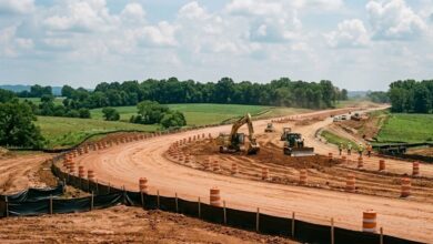
- Phase 2: Extension of the roadway as a rural major arterial, setting the foundational alignment
- Phase 3: Infrastructure development, including critical connectivity to Interstate 840 and the proposed intersection designs at Northwest Broad Street
- Phase 4: Ultimate buildout, which anticipates transition to an urban major arterial and explores the potential for a full interchange at Interstate 24
The proposed roadway—named Cherry Lane east of I‑840 and Stonesbattle Parkway west of I‑840—will extend from Lebanon Pike (US 231) westward across I‑840, continuing to Northwest Broad Street (US 41), Florence Road, and ultimately toward I‑24. Whether the corridor will include a new interchange at I‑24 remains undetermined.
“The corridor is one of the most significant future transportation investments in Murfreesboro,” said City Manager Darren Gore. “By linking multiple major arterials, the roadway is expected to provide much‑needed east‑west capacity relief, reduce congestion on parallel routes, and open new opportunities for coordinated development. We anticipate that the new roadway’s connectivity will make the area one of the most attractive locations for new commercial, mixed-use, and employment-based development.”
A major focus of the Plan is fostering smart growth. The City’s Planning Commission recently adopted new land-use maps for the corridor, replacing previous designations to better align with mixed-use, commercial, and residential development goals. This approach is intended to reduce the frequency and distance of vehicle trips by creating more integrated environments where residents can live, work, and access services within shorter distances.
Because the proposed new roadway is expected to carry substantial traffic volumes, the City anticipates increased development pressure along the corridor. The small‑area Plan offers land‑use guidance beyond the broader Murfreesboro 2035 Comprehensive Plan, which was last amended in 2023. The Corridor Plan supersedes the Murfreesboro 2035 Future Land Use Map within the study area.
City transportation planners anticipate the corridor will:
- Improve regional mobility by connecting US 231, I-840, US 41, and I-24
- Provide capacity relief for parallel east-west routes experiencing congestion
- Support future multimodal improvements, including potential pedestrian and bicycle facilities
- Enhance network resilience, offering alternative routes for daily traffic and emergency response
The study area also involves ongoing coordination with the Tennessee Department of Transportation (TDOT) regarding the I-24 Choice Lanes project. While final details regarding the I-24 connection—whether a full interchange or a grade-separated flyover—are under review, the city maintains that the corridor is a vital long-term component of Murfreesboro’s transportation infrastructure.
Construction is expected to advance in coming phases, with the City actively pursuing federal and state funding, including recent grant applications, to support the estimated $150 million total project cost.
The Stonesbattle Parkway Corridor Plan is available within the full agenda for the May 21, 2026, City Council meeting and is available on the City’s website Agenda Center.